


Riverside Precinct 04, Sedgwick County, Kansas
About
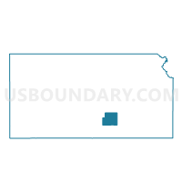
Outline

Summary
| Unique Area Identifier | 587128 |
| Name | Riverside Precinct 04 |
| County | Sedgwick County |
| State | Kansas |
| Area (square miles) | 5.13 |
| Land Area (square miles) | 5.03 |
| Water Area (square miles) | 0.10 |
| % of Land Area | 97.98 |
| % of Water Area | 2.02 |
| Latitude of the Internal Point | 37.61923070 |
| Longtitude of the Internal Point | -97.28315970 |
Maps


Graphs
Select a template below for downloading or customizing gragh for Riverside Precinct 04, Sedgwick County, Kansas


Neighbors
Neighoring Voting District (by Name) Neighboring Voting District on the Map
- Gypsum Precinct 01, Sedgwick County, KS
- Gypsum Precinct 02 A, Sedgwick County, KS
- Minneha Precinct 05 A, Sedgwick County, KS
- Riverside Precinct 02 E, Sedgwick County, KS
- Riverside Precinct 03, Sedgwick County, KS
- Wichita Precinct 309, Sedgwick County, KS
- Wichita Precinct 311, Sedgwick County, KS
- Wichita Precinct 311 A, Sedgwick County, KS
- Wichita Precinct 311 C, Sedgwick County, KS
- Wichita Precinct 315, Sedgwick County, KS
Top 10 Neighboring County Subdivision (by Population) Neighboring County Subdivision on the Map
- Wichita city, Sedgwick County, KS (382,368)
- Riverside township, Sedgwick County, KS (13,615)
- Gypsum township, Sedgwick County, KS (7,379)
- Minneha township, Sedgwick County, KS (3,417)
Top 10 Neighboring Place (by Population) Neighboring Place on the Map
Top 10 Neighboring Unified School District (by Population) Neighboring Unified School District on the Map
Top 10 Neighboring State Legislative District Lower Chamber (by Population) Neighboring State Legislative District Lower Chamber on the Map
- State House District 87, KS (26,547)
- State House District 82, KS (24,960)
- State House District 81, KS (23,242)
- State House District 96, KS (23,195)
- State House District 88, KS (21,279)
- State House District 98, KS (20,631)
Top 10 Neighboring State Legislative District Upper Chamber (by Population) Neighboring State Legislative District Upper Chamber on the Map
Top 10 Neighboring 111th Congressional District (by Population) Neighboring 111th Congressional District on the Map
Top 10 Neighboring Census Tract (by Population) Neighboring Census Tract on the Map
- Census Tract 100.04, Sedgwick County, KS (5,982)
- Census Tract 56, Sedgwick County, KS (5,019)
- Census Tract 59, Sedgwick County, KS (4,446)
- Census Tract 58, Sedgwick County, KS (4,404)
- Census Tract 61, Sedgwick County, KS (2,929)
- Census Tract 66, Sedgwick County, KS (2,698)